
File:Canada change 1870-07-15.png
Original file (1,800 × 1,496 pixels, file size: 510 KB, MIME type: image/png)
| This is a file from the Wikimedia Commons. Information from its description page there is shown below. Commons is a freely licensed media file repository. You can help. |
Summary
| Description |
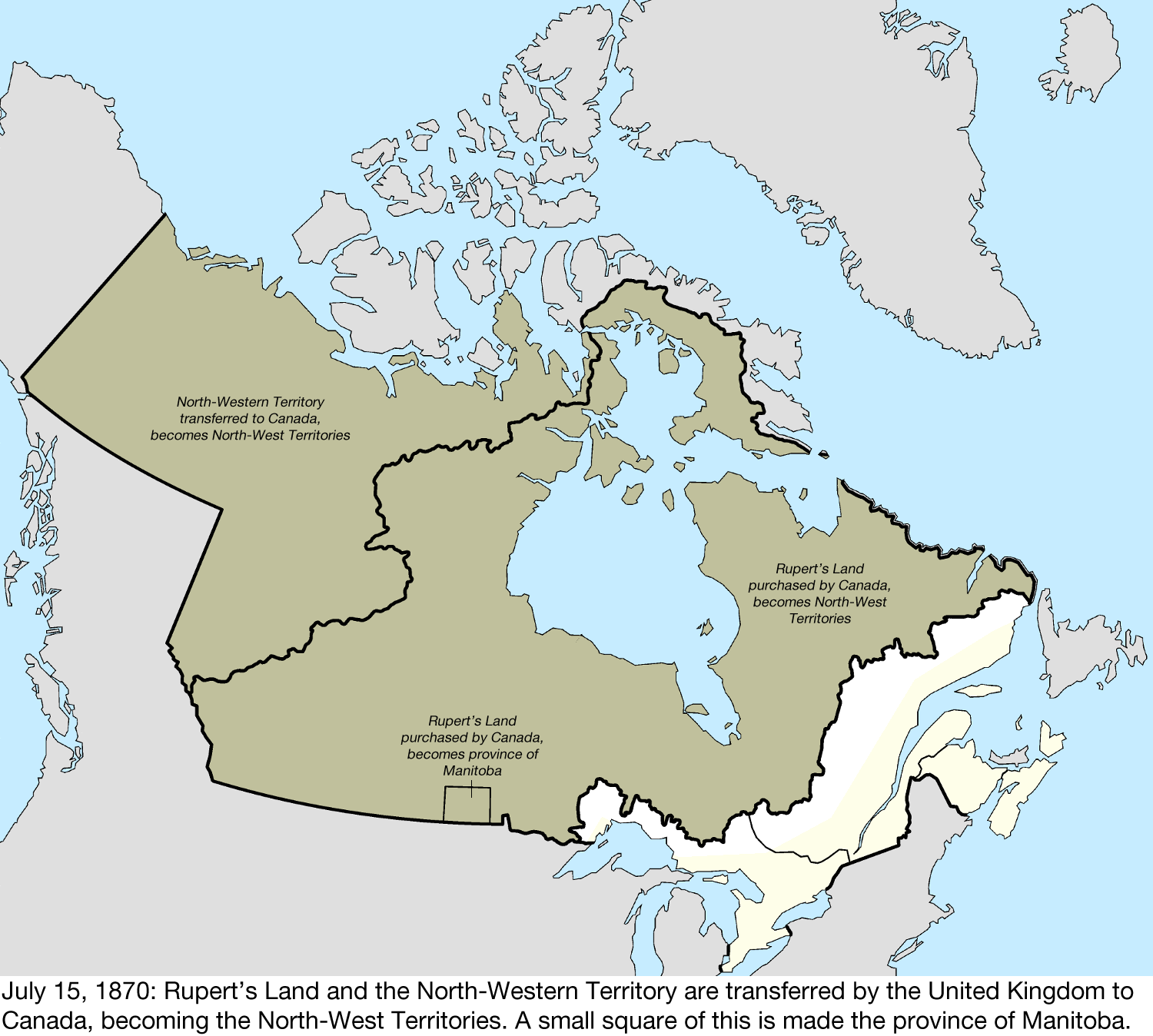
English: Map of the change to Canada on July 15, 1870.
The United Kingdom transferred most of its remaining land in North America to Canada, with the North-Western Territory and Rupert's Land becoming the North-West Territories. Rupert's Land was transferred to Canada in 1869,[1] but the transfer was only consummated in 1870 when £300,000 was paid to the Hudson's Bay Company.[2] Due to a vague description and lack of quality surveying, part of the western border with the United States was unclear and disputed.[3] Canada disagreed with the United Kingdom over the extent of Labrador that remained with Newfoundland Colony, citing the historical use of the term "Coasts of Labrador." A rectangular area of the newly acquired region around the city of Winnipeg was made the province of Manitoba.[4] This was built with the shapefiles:
|
| Date | |
| Source | Own work |
| Author | Golbez |
Licensing
- You are free:
- to share – to copy, distribute and transmit the work
- to remix – to adapt the work
- Under the following conditions:
- attribution – You must give appropriate credit, provide a link to the license, and indicate if changes were made. You may do so in any reasonable manner, but not in any way that suggests the licensor endorses you or your use.
- share alike – If you remix, transform, or build upon the material, you must distribute your contributions under the same or compatible license as the original.
File history
Click on a date/time to view the file as it appeared at that time.
| Date/Time | Thumbnail | Dimensions | User | Comment | |
|---|---|---|---|---|---|
| current | 20:23, 11 June 2024 | | 1,800 × 1,496 (510 KB) | Golbez | New version. |
| 00:42, 20 January 2017 |  | 1,500 × 1,348 (401 KB) | Golbez |
File usage
Global file usage
The following other wikis use this file:
- Usage on fr.wikipedia.org
- Usage on sr.wikipedia.org